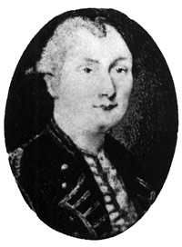
Holland College is named after Samuel Holland, a highly-esteemed 18th century surveyor who had strong ties to Prince Edward Island. A collection of Samuel Holland artifacts is on display in the foyer of the Centre for Applied Science and Technology on our Prince of Wales Campus. Holland was well respected by his peers as a man dedicated to his profession, the advancement of technology, and education. He was commissioned by the British government to survey and map a significant portion of the lands on the eastern seaboard of North America.
Holland began his work in Prince Edward Island. Some 200 years after they were created, his maps are acknowledged by surveyors as being extremely accurate; so accurate, that if his map of P.E.I. – the first ever drawn – is overlaid on a satellite image, there are very few variations.
At Holland College, we are proud of the connection that we have to this visionary. Holland’s dedication to progress, his willingness to embrace new technology, and his enthusiasm for teaching embody the principles that we hold very close to our hearts.
Davies, Blowden. “The Romance of a Map Maker”. The Canadian Magazine. October, 1928.
Lockerby, Earle, Sobey, Douglas. Samuel Holland: His work and legacy on Prince Edward Island. Island Studies Press & Holland College. 2015.
Suthren, Victor. “Creating the Instrument: The Transformation of James Cook in North American Waters, 1758-1767”. Soundings. Issue 2, Spring 2005. www.hmsrichmond.org.
F. J. Thorpe. Dictionary of Canadian Biography. www.biographi.ca.